Skip to content

Lower Nahal Tze'elim

More info

About

Lower Nahal Tze'elim

A hike in Nahal Tze’elim is always fascinating and belongs in the trip-category of strong walkers.

Lower Nahal Tze’elim begins in the night-camp of Nahal Tze’elim. The track leads along the stream to Ein Namer, and returns to the starting point in the night-camp.

The route is through an open landscape exposed to the sun, so it’s important to stock up with 4.5 liters of water, per hiker.

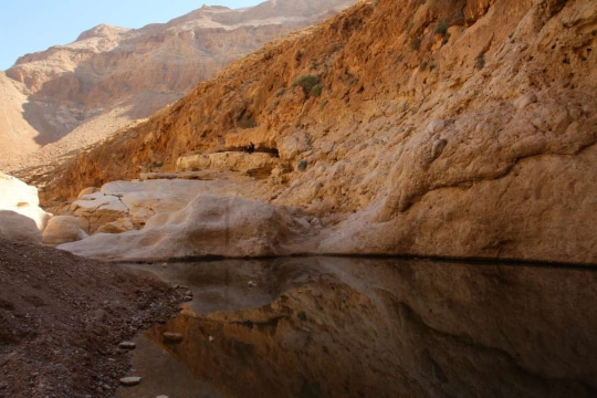
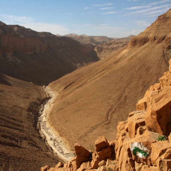
The track is breathtaking due to its vast rock walls and cliffs. All along the route are water caverns that are brimming after a flood-filled winter.
At the end of the track – just before returning on the marked paths back to the night-camp – you can continue a little to Ein Namer. Here, you will find a magical spring bubbling out of a cool, shady cave.

It’s important to pay attention to the trail markings and recommended to come equipped with Trail Map #11.

  • Trail Length: approx. 11 kilometers
  • Trail Duration: approx. 4.5 hours
  • Degree of Difficulty: for good walkers
  • Recommended Season: spring/autumn/winter
  • Trail Map: #11
  • Starting and Finishing Point: Nahal Tze’elim night-camp. Entrance from Route 90: between signs for 234-235 kms, on red-marked road ~4 kms to the night-camp.


Please note:
during the summer, due to the intense heat that prevails in the area, it is recommended to make the trip at sunrise.

The itinerary, as described above, is a recommendation only, and those who choose to take this trip do so at their own discretion and responsibility. The Regional Councils will not be held accountable in the event of any adverse consequences that may ensue.
Facilities and services

General details about the place
  • Degree of Difficulty: for good walkers
  • Entering Water
  • Free Entry
  • Night Camp
  • Round trip
  • Suitable alone
  • Suitable for families
  • Walking trail

Contact Lower Nahal Tze'elim

Location on the map
Contact
Email|[email protected] Address|

Nahal Tze’elim night-camp.

Phone|08-6688861
Hours of Activity|

24/7
בשל החום הכבד השורר באיזור בתקופת הקיץ מומלץ לעשות את הטיול עם הזריחה

Leave details and we will get back to you

שאלות נפוצות

  • How long is the Lower Nahal Tze'elim trail and how long does it take?

    The trail is approximately 11 kilometers long and takes about 4.5 hours to complete.
  • What is the difficulty level of this hike?

    This hike is rated for good/strong walkers, as it passes through open, sun-exposed terrain.
  • What should I bring on this hike?

    It's essential to bring at least 4.5 liters of water per hiker, and it's recommended to bring Trail Map #11 and pay close attention to trail markings.
  • What can I see along the trail?

    The trail features breathtaking vast rock walls and cliffs, along with water caverns that are brimming after a flood-filled winter. Near the end, you can visit Ein Namer, a magical spring bubbling out of a cool, shady cave.
  • What is the recommended season to hike this trail?

    Spring, autumn, and winter are the recommended seasons. In summer, due to intense heat, it's best to start the hike at sunrise.
  • Where does the trail start and end?

    The trail starts and finishes at the Nahal Tze'elim night-camp, and follows a circular route along the stream to Ein Namer and back.
  • How do I get to the starting point?

    Enter from Route 90 between the signs for km 234-235, then follow the red-marked road for approximately 4 km to the night-camp.
Additional experiences that may interest you
Tracks
Duration: 04:00 hours

Nahal Og

The stream channels of Nahal Og begin in northeast Jerusalem, and run parallel to Route 1 on the way to...
Tracks
Duration: 02:00 hours

Ein Bokek

The trail to Ein Bokek, in the Bokek Stream, is an enchanting experience in the Dead Sea Land, and is...
Tracks

The Marlstone Gorge

The circular cycling trail of Kikar Sodom offers a great cycling experience through the marlstone landscape, with diverse rock shapes...
On the map