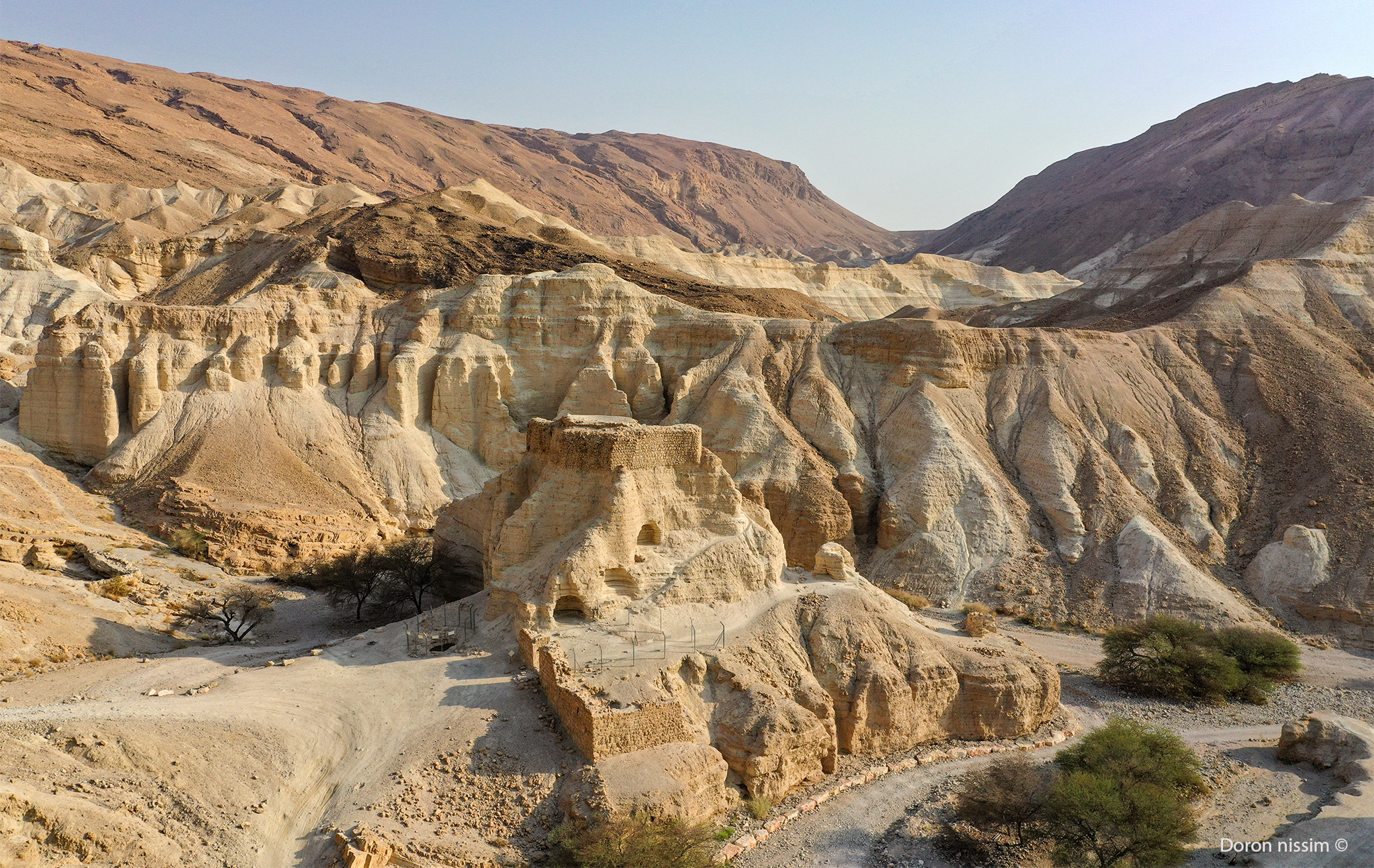
Zohar Stream
A lovely, family-friendly path in a beautiful desert landscape by the Dead Sea’s hotels. Travel through a narrow and impressive canyon carved from limestone rock, with a few challenges along the way. At the end, you’ll reach Mehad Zohar, which sits on chalk and marl rocks, remnants of Lake Lisan which once covered the entire Jordan Valley.
Route Description
From Arad: Drive along Highway 31 from Arad to the Dead Sea. Pass the turnoff to Eilat. Turn right at Neve Zohar. From Jerusalem: Drive along Highway 90 along the Dead Sea. Pass the Dead Sea hotels. After about 5 minutes, turn left to Neve Zohar. You may park in Neve Zohar.
The route starts at Neve Zohar. Leave the settlement through a small gate in the southern fence. Continue up to the right where you’ll see green markings that will appear along the entire river trail. After enjoying the shade of the acacia trees, the stream narrows and turns into a beautiful canyon. The climb is easy with the help of pegs. After about half a kilometer, you’ll pass a dry waterfall at a height of 6 meters on your left. With the help of pegs, continue walking for another 300 meters and cross the vehicle road. You can also take a shortcut by turning right on the vehicle road. Then you’ll return to the main road and Neve Zohar by following the blue-marked trail.
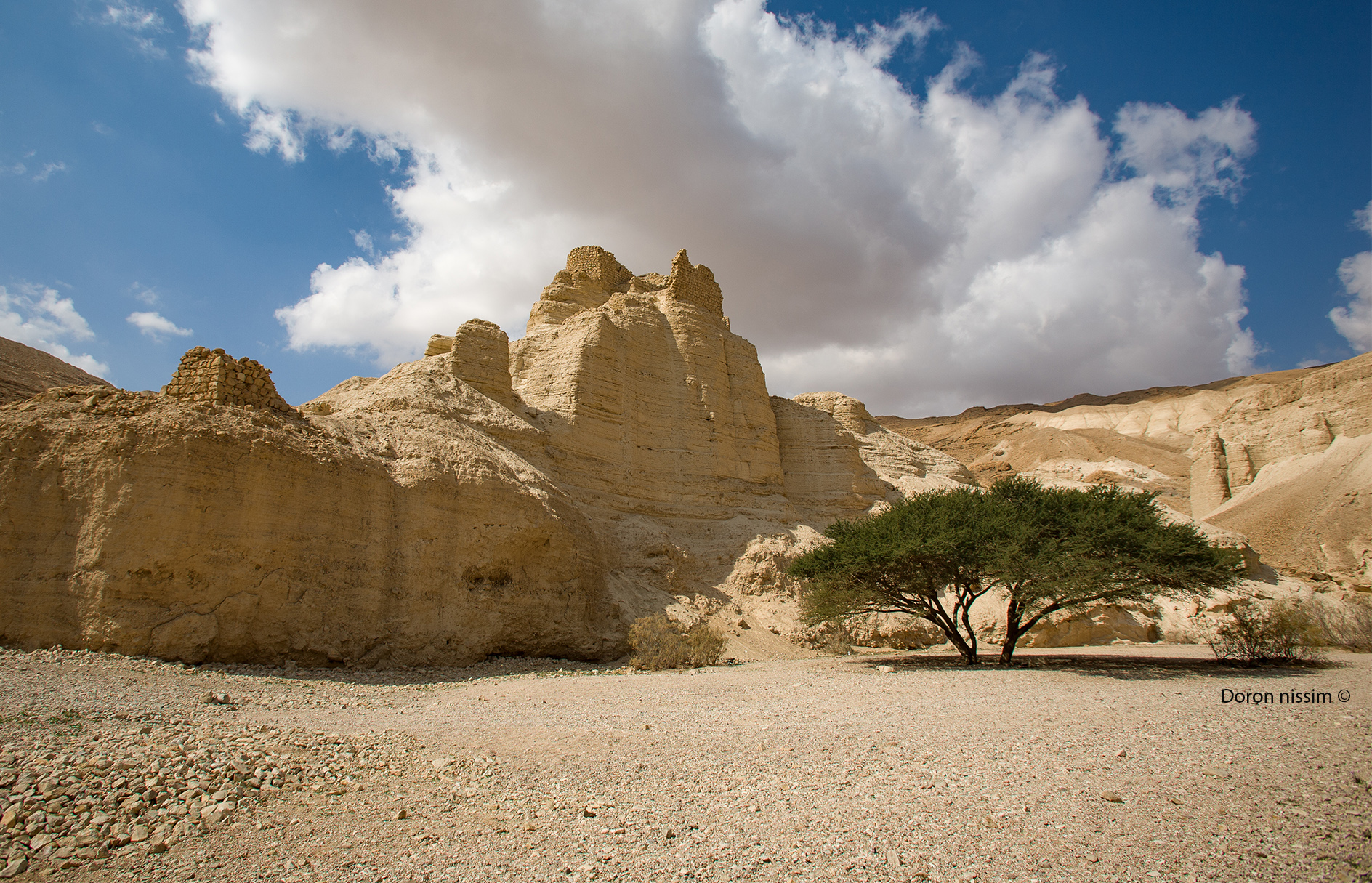
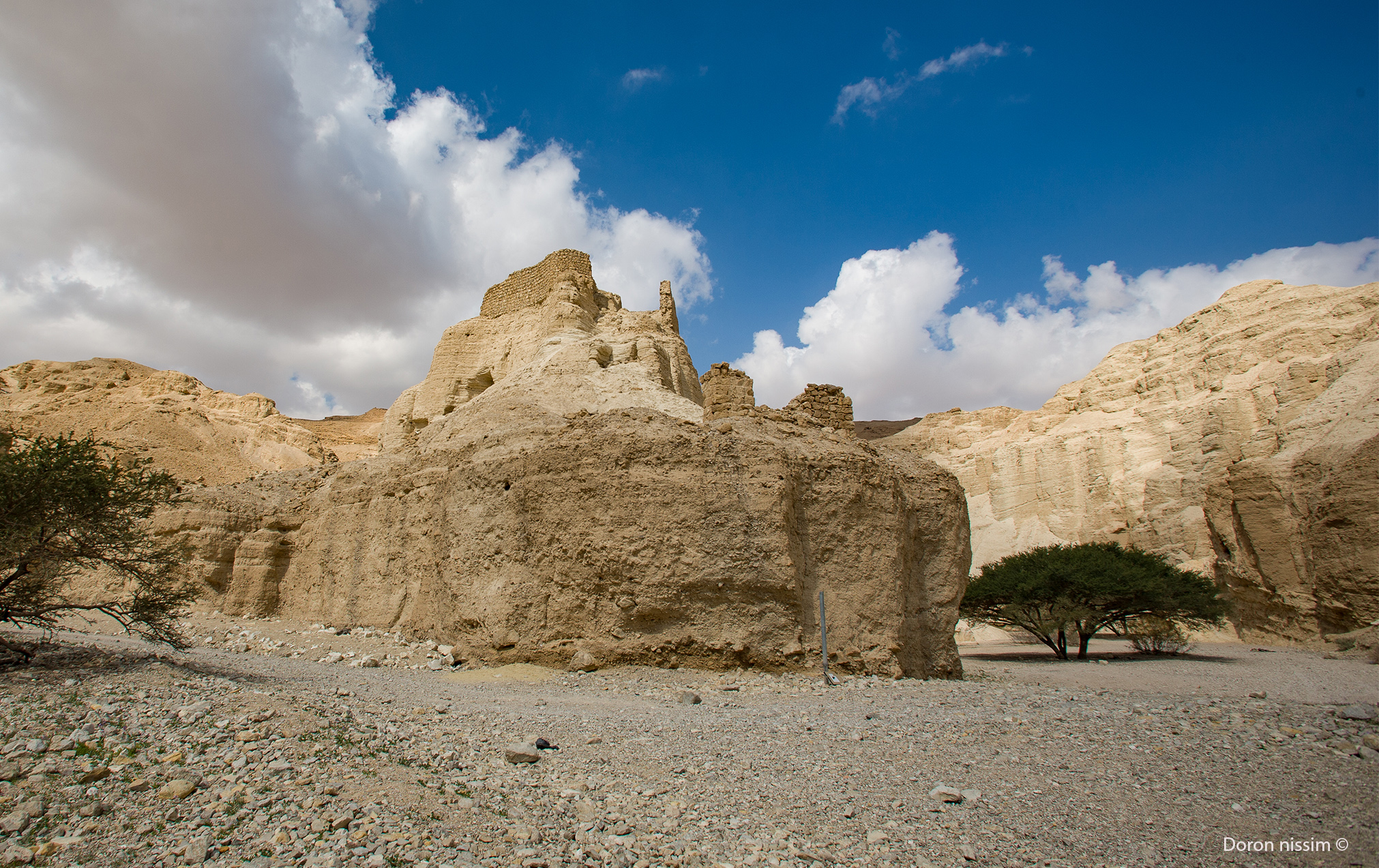
It’s recommended to continue the trip up to the stream. After about 1 kilometer of walking, you’ll reach Zohar Fortress, dating from Roman times. Entry to the small stronghold is prohibited, but the surrounding area is beautiful nonetheless. If you continue west another 50 meters, you’ll come to a natural rock slide that the kids will enjoy. From here, return by car to the main road.
Starting and ending point: Neve Zohar
Target audience: Hiking enthusiasts, families
Route length: 2 kilometers, circular (an additional trek to the Zohar Citadel and back is 1.5 kilometers)
Trail Duration: About two hours.
Level of difficulty: medium
Recommended season: Spring, winter, autumn.
Trail Marking Map: Judean Desert (11)
Important Information
The trail is not suitable for hiking on rainy days. Do not hike in the area’s streams when there is risk of flooding. For those who are interested, the vehicle road above the canyon is a good and safe place to watch the flood. Do not attempt to cross the channel when there is danger of flooding in the summer. Sunrise and sunset walks are recommended.
The itinerary, as described above, is a recommendation only. Those who choose to take this trip do so at their own discretion and responsibility. The Regional Councils will not be held accountable in the event of any adverse consequences that may occur.